
Mobile Mapping
Our mobile mapping solutions offer survey-grade accuracy together with long-range capability with the greatest flexibility, compatibility, connectivity and efficiency.
Mobile Mapping
Our mobile mapping solutions offer survey-grade accuracy together with long-range capability with the greatest flexibility, compatibility, connectivity and efficiency.
Our Mobile Mapping Survey Equipment Range:
We aim to not only to sell a product, but to provide a professional solution.
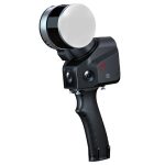
SLAM100 Handheld
The SLAM100 is the first handheld lidar scanner launched by Feima Robotics.
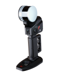
YHS12C SLAM Scanner
The YHS12C is an intrinsically safe 3D lidar scanner that can be used in gas and coal mining operations.
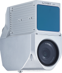
Alpha 3D Mobile Mapping
CHC Alpha3D is a vehicle independent mobile mapping platform
AplhaAir450
Airborne LiDAR system with built-in IMU, GNSS, 3D Scanner and 24MP camera.
AplhaUni Mapping System
Long-range high-end LiDAR solutions, provide the most universal installation.
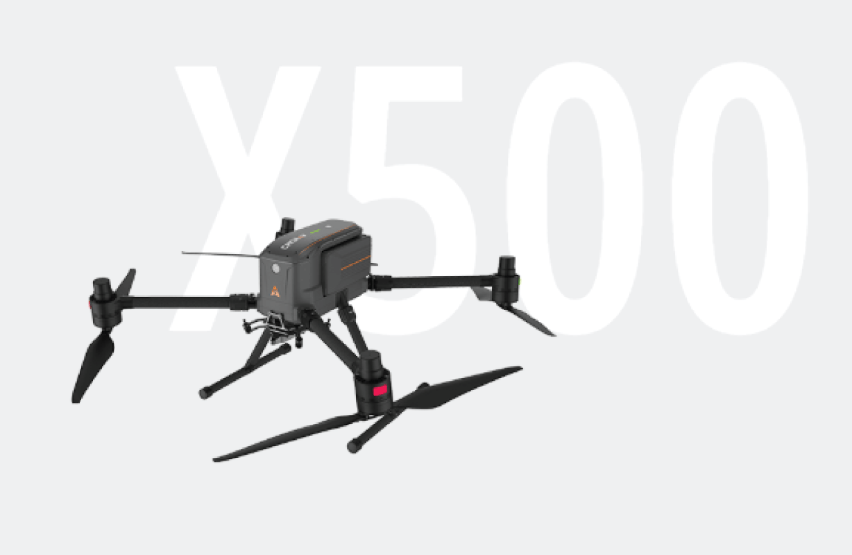
X500 UAV Platform
Professional UAV Reality Capture Platform.
CHCNAV AlphaAir 10
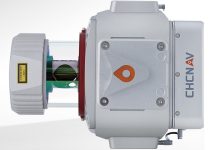
The AlphaAir 10 is a professional airborne LiDAR+RGB system designed to meet the demanding requirements
CHCNAV AlphaAir 15
The AlphaAir 15 (AA15) is a lightweight, high-performance airborne LiDAR system designed for large-scale operations
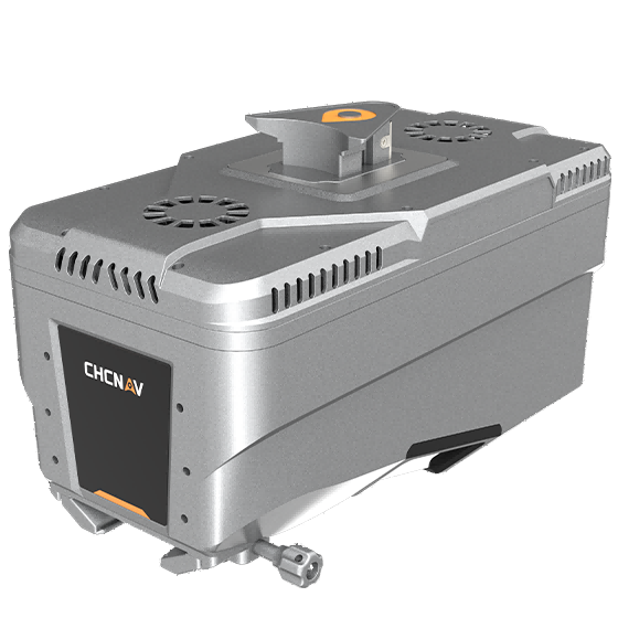
CHCNAV AlphaUni 20
The AlphaUni 20 is a cost-effective, premium-class multi-platform mobile mapping system
Wide-coverage dual-camera LiDAR for demanding UAV surveys
Up to 2,100 m range
Up to 2,000 kHz pulse rate
Up to 16 returns
1.85 kg integrated system
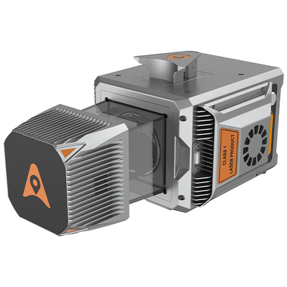
CHCNAV AlphaAir 6 Dual (AA6D)
Capture LiDAR and high-quality imagery across wide corridors and large-area projects with dual 26 MP APS-C cameras and a 110° horizontal field of view.
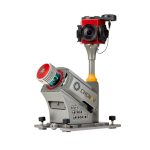
TX73 GNSS Guidance
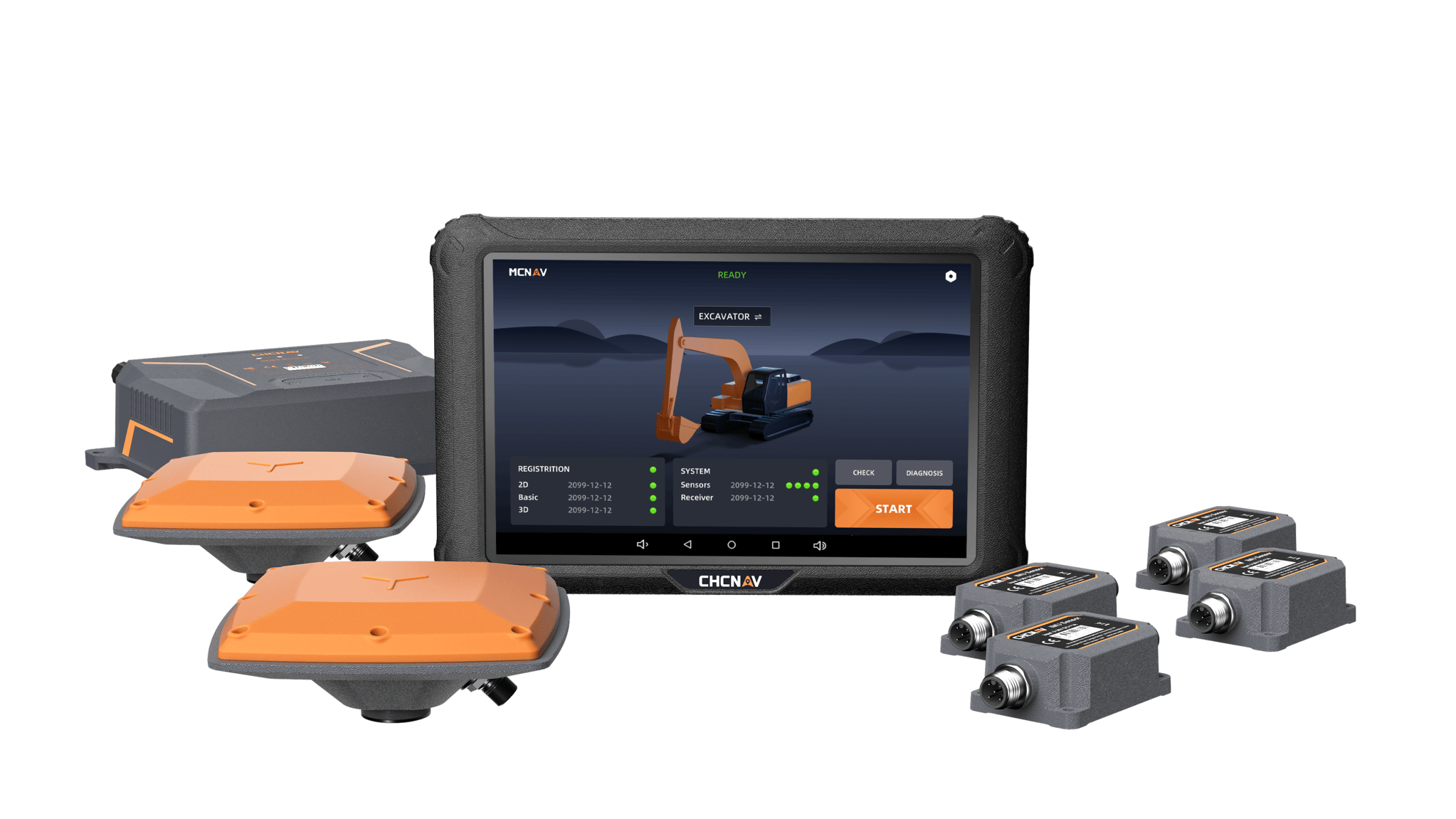
Premium RTK GNSS Excavator Guidance
Social Media
© 2025 MMS Design | All Rights Reserved | Web SEO by: DNASuperSystems