
LandStar Survey Software for Android
LandStar 8 is the newest field-proven survey software solution for Android. Designed for high precision surveying and mapping tasks for your everyday work.
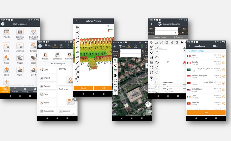
If you are new to LandStar, you will be impressed by its seamless work mode management, easy-to-use and easy-to-learn graphical user interface with simple operation. Extensive data import/export formats and multiple types of measurement and stakeout methods ensure instant productivity.
Landstar is also an excellent GIS data capturing software app.
FEATURES

STREAMLINED WORKFLOWS AND SIMPLIFIED OPERATIONS
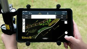
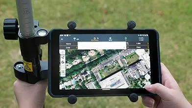
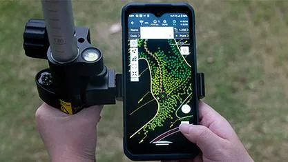
LandStar 8 prioritizes user-friendly operation, making surveying and mapping tasks accessible to all users. With a clean, intuitive layout and sharp graphics, only relevant information is displayed, minimizing clutter and simplifying the interface. Integrated video tutorials further assist field operators in quickly mastering the app's capabilities.

EFFICIENT COLLABORATION FROM FIELD TO OFFICE
LandStar 8 streamlines project and coordinate system management, allowing users to conveniently copy settings, control points, and stake-out points from other handheld controllers by simply using the share code feature. The application's cloud-based architecture facilitates efficient collaboration between field crews and office staff, enabling project backup, data storage, and remote support for personalized technical assistance.

COMPREHENSIVE FEATURE SET
Based on easy-to-use workflow management and an intuitive graphical interface, the LandStar 8 seamlessly integrates a wide range of surveying features for diverse applications such as construction surveying, control point surveying, road construction, and more. Its robust data import and export capabilities, supporting industry-standard formats, enable seamless integration into existing software environments, ensuring immediate productivity.

ACCELERATED CAD RENDERING AND SMARTER MAPPING
The enhanced MetaCAD graphics engine handles larger CAD files up to 200 MB on CHCNAV handheld controllers with smoother graphics rendering, faster file loading times, and an improved user experience. In addition, LandStar 8 introduces intelligent mapping features such as Quick Code, which enables one-click feature coding to automatically create line features, significantly increasing project productivity. LandStar 8 supports opening external reference files, automatically recognizes CAD length units and directly allows CAD base map editing in the field.
How to videos
Calibrate easy:
Import Data:
Share files easily:
Visit our YouTube Channel for more training and related videos

Specifications
Connectivity
Device : Bluetooth, Wi-Fi
Cloud : Data storage and remote support
Connectivity
Device : Bluetooth, Wi-Fi
Cloud : Data storage and remote support
Connectivity
Device : Bluetooth, Wi-Fi
Cloud : Data storage and remote support
Features
Functions : Data collection, stakeouts volumes and much more.
File formats : SHP, DWG, DXF, KML, GPX, TIFF, JPG, MBTiles
Contact Details
086 111 2783
021 975 7043
Quick Links
Home
Shop Online
Get a Quote
Software
Equipment
Training
Privacy Policy
Contact Us
Social Media
© 2025 MMS Design | All Rights Reserved | Web SEO by: DNASuperSystems