
South Africa · +27 21 975 7043 · [email protected]

☰
AGRICULTURE SOLUTIONS
State of the art automated steering solutions for agriculture.
South Africa · +27 21 975 7043 · [email protected]
☰
AGRICULTURE SOLUTIONS
State of the art automated steering solutions for agriculture.
Our range includes steering solutions for:
Tillage, seeding, fertilization, pesticide, and harvesting applications.
We aim to not only to sell a product, but to provide a professional solution.
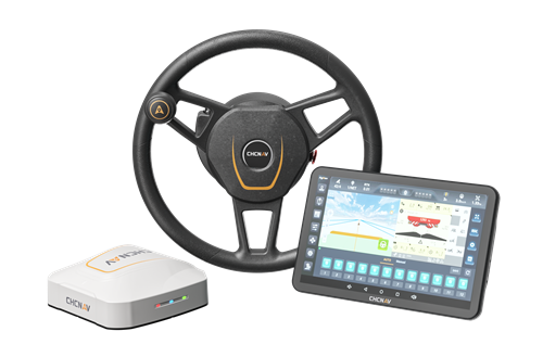
NX612
Autosteering System
The CHCNAV NX612 Automated Steering System delivers reliable performance in diverse agricultural landscapes. It connects seamlessly to GNSS RTK networks and CHCNAV PointSky satellite correction services, providing ±2.5 cm accuracy even in remote areas without network coverage, making it suitable for precision farming anywhere.
Wide-coverage dual-camera LiDAR for demanding UAV surveys
Up to 2,100 m range
Up to 2,000 kHz pulse rate
Up to 16 returns
1.85 kg integrated system
CHCNAV AlphaAir 6 Dual (AA6D)
Capture LiDAR and high-quality imagery across wide corridors and large-area projects with dual 26 MP APS-C cameras and a 110° horizontal field of view.
© 2026 MMS Design | All Rights Reserved