
SLAM100 Handheld Laser Scanner
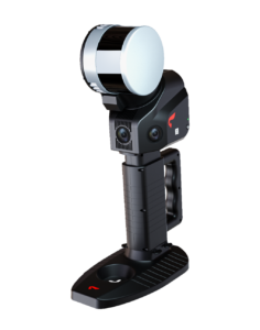
SLAM100
The SLAM100 is the first handheld lidar scanner launched by Feima Robotics.
The system has a 360-degree rotating head, which can form a 270-degree X 360-degree point cloud coverage.
Combined with the industry-level SLAM algorithm, it can obtain high-precision three-dimensional point cloud data of the surrounding environment without light and GPS.
Advanced scanning Solution
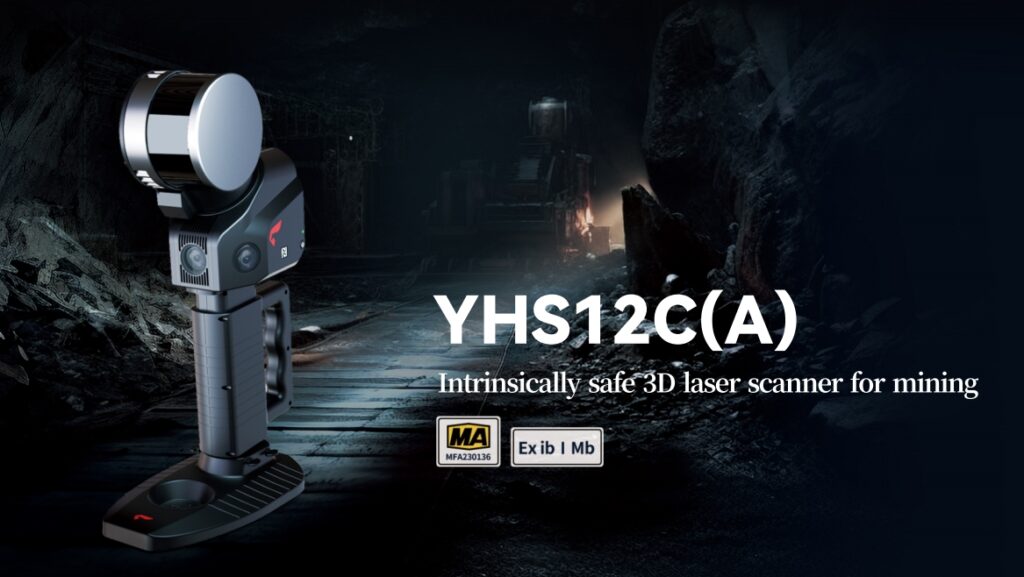
360° Rotating Head: The SLAM100-YHS12C offers a 270°×360° point cloud coverage, ensuring comprehensive data collection.
Precision and Accuracy
Industry-Leading SLAM Algorithm: This ensures high-precision 3D point cloud data with a relative accuracy of 2 cm and an absolute accuracy of 5 cm.
Automatic Control Point Collection: The scanner can automatically collect and extract control points, facilitating easy georeferencing of the data.
Durable and Portable
The device features an integrated design with built-in control and storage systems. It is equipped with replaceable lithium batteries, providing up to 2.5 hours of continuous operation.
High Resolution Cameras
Equipped with three 5-megapixel cameras, the scanner captures detailed texture information, allowing for the creation of color point clouds and partial panoramic images.
Equipped with three 5-megapixel cameras, the scanner captures detailed texture information, allowing for the creation of color point clouds and partial panoramic images.
VERSATILE CONNECTIVITY
External Interfaces
The device supports various external interfaces, allowing it to connect with panoramic cameras, GPS modules, UAVs, and vehicles. This versatility enables diverse data collection applications.
Mobile and PC Applications
The SLAM GO mobile app (compatible with Android and iOS) provides real-time
point cloud display, project management, and firmware updates. The SLAM GO POST software on PC offers comprehensive post-processing capabilities.
Applications
Wide Range of Uses: The SLAM100-YHS12C is suitable for traditional surveying, 3D digitization, emergency response, underground mapping, cultural relics protection, and more. It is particularly effective in GPS-denied environments.
Specifications
Laser Scanning
Field of View (FOV): 270°×360°
Laser Pulse Repetition Rate: 320 kHz
Maximum Range: 120 m
Cameras
Resolution: 5 Megapixels
Horizontal FOV: 200°
Vertical FOV: 100°
Battery Life:
2.5 hours of continuous operation with built-in batteries.
Additional Features:
SLAM GO App: Provides project management, real-time point cloud display, image preview, and firmware upgrades.
Post-Processing Software: SLAM GO POST software for high-precision color point cloud generation, partial panoramic images, and data optimization.
Compatible with UAVs: Can be mounted on UAV platforms for air-ground or indoor-outdoor data collection.
Wide-coverage dual-camera LiDAR for demanding UAV surveys
Up to 2,100 m range
Up to 2,000 kHz pulse rate
Up to 16 returns
1.85 kg integrated system
CHCNAV AlphaAir 6 Dual (AA6D)
Capture LiDAR and high-quality imagery across wide corridors and large-area projects with dual 26 MP APS-C cameras and a 110° horizontal field of view.