
Alpha 3D Mobile Mapping Platform
Alpha 3D
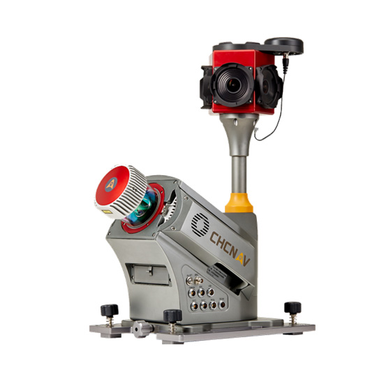
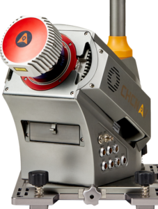
CHC Alpha3D is a vehicle independent mobile mapping platform that combines the following main hardware components into an extremely robust and efficient solution:
Riegl VUX-1HA laser scanner
FLIR LadyBug5plus 360⁰ spherical camera
KVH1750 IMU
Novatel Propack6 GNSS receiver
FEATURES
High accuracy: 2-3 cm absolute system accuracy, 5 mm scanner relative accuracy with low range noise, one of best in its class GNSS and IMU units
Accurate results, every detail in focus: we use a combination of high-density point clouds and high-resolution panorama images, which are precisely synchronized to each other
Dominant performance (Productivity): 235 m scanning range (420 m max.), 1 Million points/s scanning speed, 250Hz scanner rotation speed
Robust: IP64, operational temp. from -100C to +400C
Lightweight: 19 kg unit, 16.6 kg optional roof rack extension, small size
Vehicle-independent platform
Future upgrade ready (Connectivity)

APPLICATIONS
Which vehicles can we mount it to?
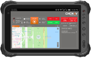
Alpha3D can be easily mounted on a variety of platforms, including different types of vehicles, trains, railway trolleys, boats, etc. This is possible because the client can use additional telescopic extensions and power the unit from an internal battery or directly from vehicle power.
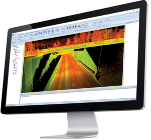
What about software?
Well, with Alpha3D we offer CoCapture Software for data acquisition and the CoProcess package to process results. Data can also be exported to other formats and used in clients own software. Export formats include LAS and PTS to name a few.
Where can the Alpha3D be used?
Further Applications
Infrastructure utilities – Powerline mapping
Infrastructure utilities – Localized mapping/inspection
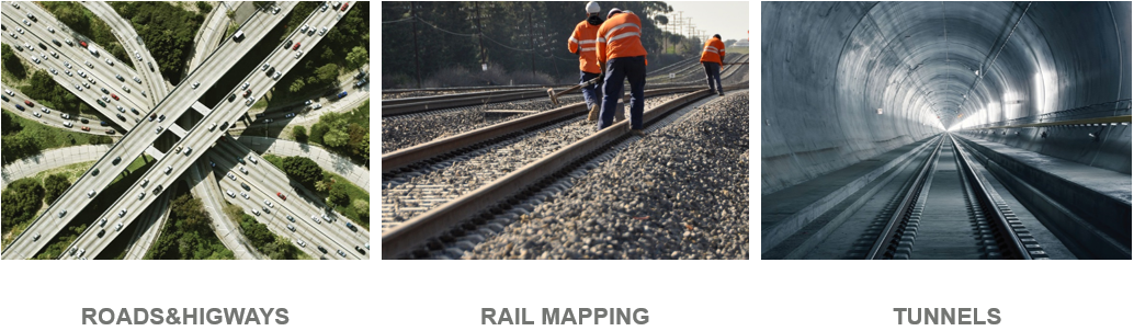
Roads & Highways – Corridor mapping
Roads & Highways – Pavement assessment
Roads & Highways – Asset management
Roads & Highways – Capture natural surface, mapping, volume calculations, DTM
Roads & Highways – Design & Visualize
Rail mapping, DTM
Rail Signaling & control
As-built rail geometry extraction
Rail network management
3D city models
Digital City Mapping – Tree cadaster
Digital City Mapping – Solar potential
Digital City – Street view Mapping for Navigation
Digital City Mapping – Virtual surveying
Digital City – Asset management
Digital City – Volumetric analysis, DTM
Digital City – Facade / Heritage modelling
Digital City Planning – Noise modelling
Digital City Planning – Traffic pattern analysis
Cadastral & Mapping – Capture features & attributes
Cadastral & Mapping – Capture natural surface, DTM
Digital Building – BIM management
Public Safety – Forensics & large event management
Public Safety – Border control & crop identification
Public Safety – Damage Assessment (Infrastructure & Building)
Airports – Capture natural surface, DTM
Airports – As-built verification
Survey & Engineering in Mining – Capture natural surface
Survey & Engineering in Mining – Capture features & attributes
Survey & Engineering in Mining – Calculate production volumes
Tunnels – capture and DTM, monitoring
Power & Plant – Scan area of interest, create a model, generate CAD drawings
Oil & Gas – Capture pipe networks
Oil & Gas – GIS & asset data capture, inspections
Water – Erosion monitoring
Water – Flood Analysis
Water – Bridge survey and modelling
And much more…
Wide-coverage dual-camera LiDAR for demanding UAV surveys
Up to 2,100 m range
Up to 2,000 kHz pulse rate
Up to 16 returns
1.85 kg integrated system
CHCNAV AlphaAir 6 Dual (AA6D)
Capture LiDAR and high-quality imagery across wide corridors and large-area projects with dual 26 MP APS-C cameras and a 110° horizontal field of view.
TX73 GNSS Guidance
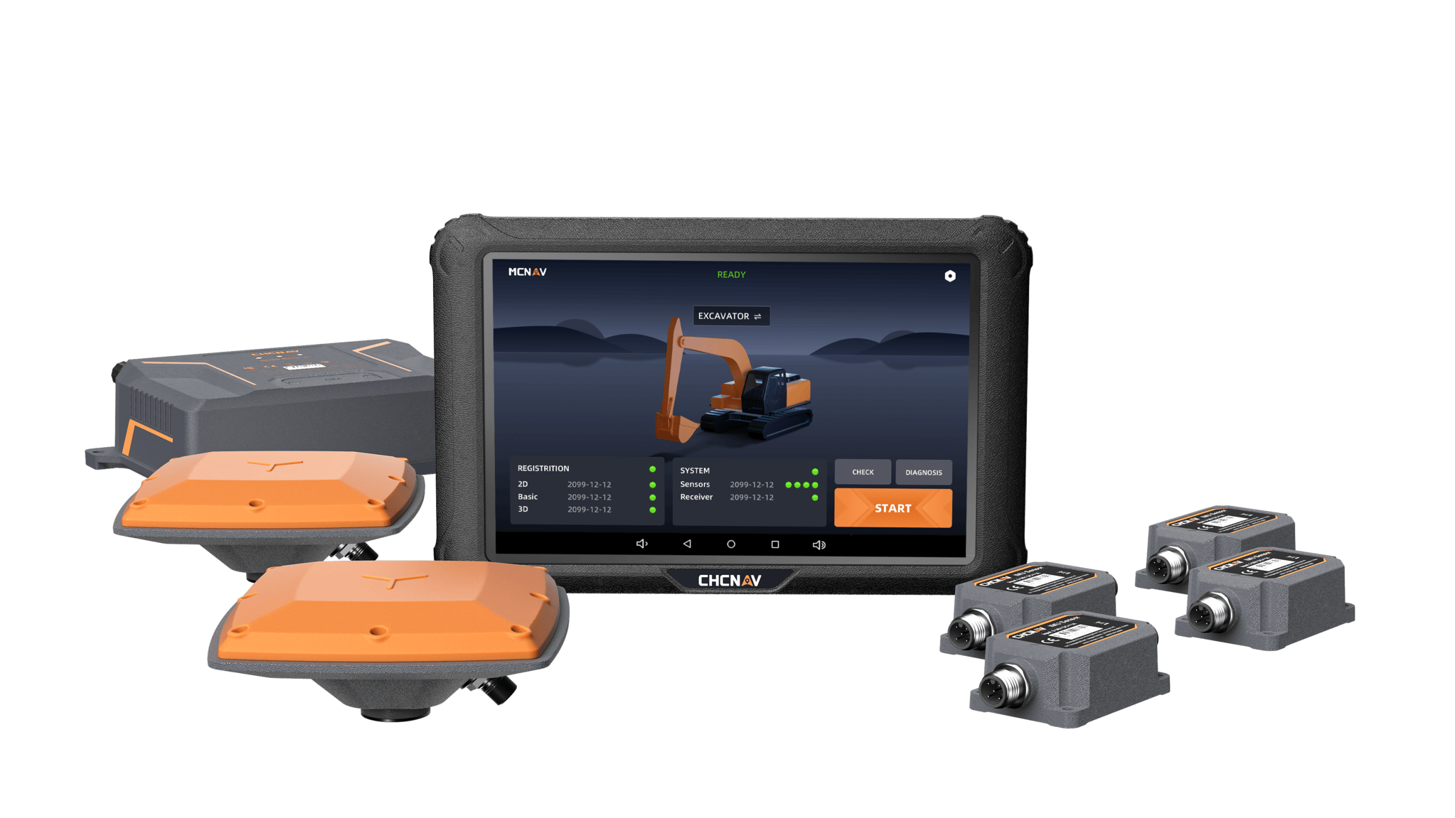
Premium RTK GNSS Excavator Guidance
Social Media
© 2025 MMS Design | All Rights Reserved | Web SEO by: DNASuperSystems