South Africa   ·   +27 21 975 7043   ·   [email protected]

SLAM200 Handheld LiDAR Scanner

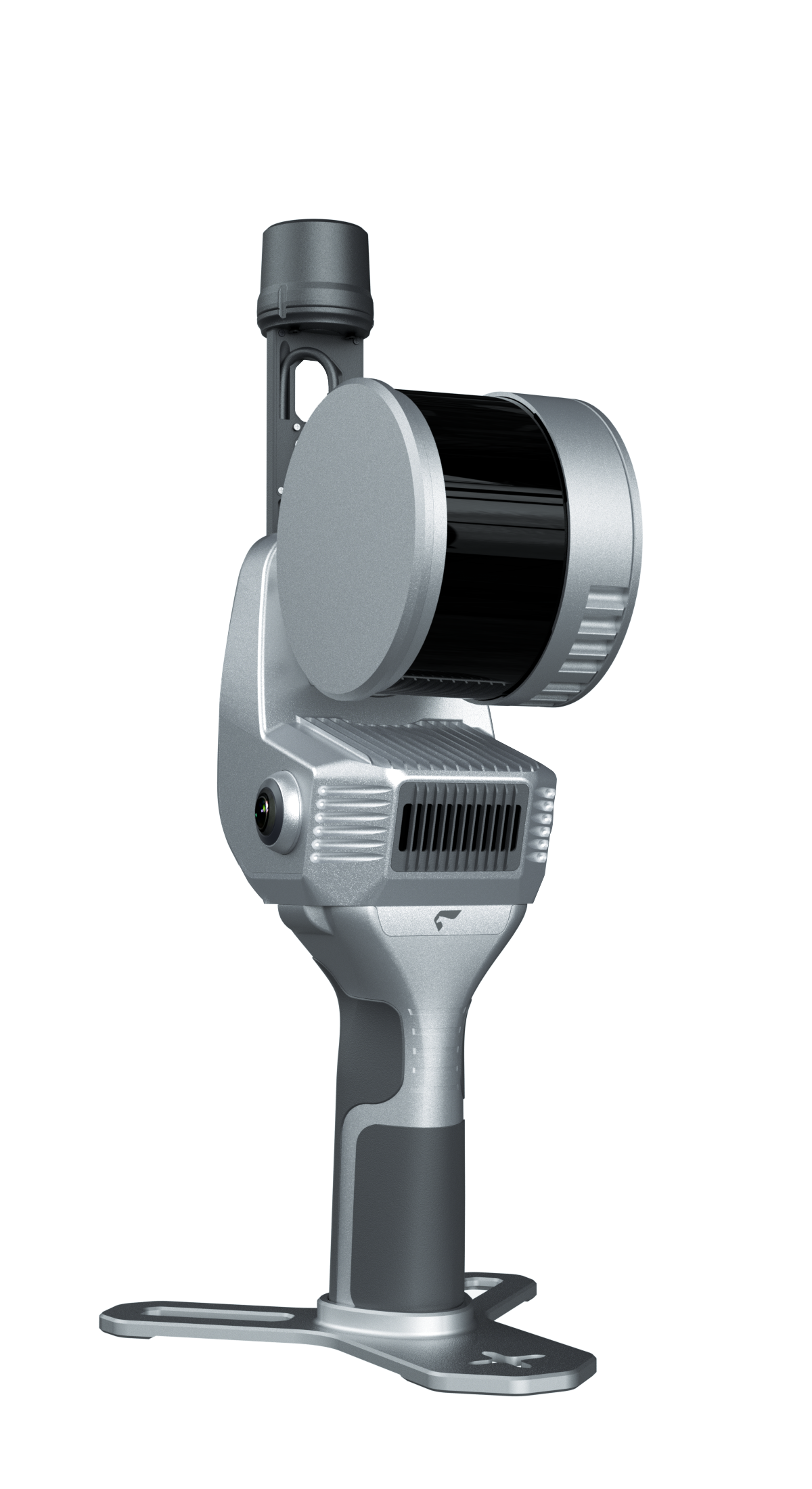
Feima SLAM200E handheld LiDAR scanner

Capture more. See more.

Turn every walk-through into detailed 3D data. Choose from three models—SLAM200, SLAM200E (16) and SLAM200 (32)—to suit your scanning requirements.

The Feima SLAM200 combines high-frequency LiDAR, dual 12MP panoramic cameras and onboard processing to capture geometry and colour in one handheld workflow.

Map indoor and outdoor spaces, including environments without GNSS reception. Review coloured point clouds on site and keep your project moving with SLAM Instant.

Talk to MMS Design about the right scanning, positioning and processing setup for your work.

Features

  • 5 mm relative accuracy within 60 m*

  • Dual 12MP panoramic cameras

  • Real-time mapping and point-cloud colouring

  • External RTK support for absolute coordinates

  • Resume scanning from the last station

  • Aerial–ground data fusion and 3D Gaussian Splatting

See the results. Explore the detail.

Explore coloured point clouds, panoramic imagery and 3D Gaussian Splatting. Ask MMS Design for representative SLAM200E sample data and a demonstration tailored to your application.

Evaluate what matters: fine detail, coverage, colour quality and compatibility with your downstream workflow.

From field to deliverable
Capture with SLAM200E. Review on site with SLAM Instant. Discuss post-processing and export requirements with our team.

*Manufacturer-stated relative accuracy of 5 mm within 60 m. Absolute accuracy up to 2 cm with external RTK or ground control. Results depend on site conditions, survey control and workflow.

Wide-coverage dual-camera LiDAR for demanding UAV surveys

Up to 2,100 m range

Up to 2,000 kHz pulse rate

Up to 16 returns

1.85 kg integrated system

CHCNAV AlphaAir 6 Dual (AA6D)

Capture LiDAR and high-quality imagery across wide corridors and large-area projects with dual 26 MP APS-C cameras and a 110° horizontal field of view.

Choose your scanning platform

SLAM200 or SLAM200E: which model fits your work?

Compare the longer-range SLAM200 with the 16-line and 32-line SLAM200E configurations. The key hardware differences are maximum measurement range, laser channels and point acquisition rate.

SLAM200

Longer-range capture

Maximum measurement range
Up to 300 m
Laser channels
32 lines
Point acquisition rate
Up to 640,000 points/second
Panoramic cameras
Dual 12MP

Consider this model when greater reach is a priority, such as larger outdoor sites and more distant building surfaces.

SLAM200E (16)

16-line configuration

Maximum measurement range
Up to 120 m
Laser channels
16 lines
Point acquisition rate
Up to 320,000 points/second
Panoramic cameras
Dual 12MP

Consider this model for work within a shorter range where the lower point acquisition rate meets your coverage and detail requirements.

SLAM200E (32)

Higher point rate within the E range

Maximum measurement range
Up to 120 m
Laser channels
32 lines
Point acquisition rate
Up to 640,000 points/second
Panoramic cameras
Dual 12MP

Consider this model when you want twice the nominal point acquisition rate of the 16-line version, within the same maximum range.

Maximum sensor range is not the same as survey accuracy or guaranteed usable range. Actual coverage and point density depend on the surface, environment, distance, scan speed and route. A higher point rate does not automatically mean higher accuracy or half the survey time. Confirm mounting accessories, software and positioning options for your chosen configuration.

Manufacturer specifications: Feima SLAM200 and Feima SLAM200E.

Ask us to compare the three models
Real spaces. Richer 3D insight.

From the site in front of you
to the detail you need.

Bring geometry and imagery together for surveying, built-environment documentation and digital-twin projects. Explore these Feima SLAM200E examples, then ask us to demonstrate the workflow for your site.

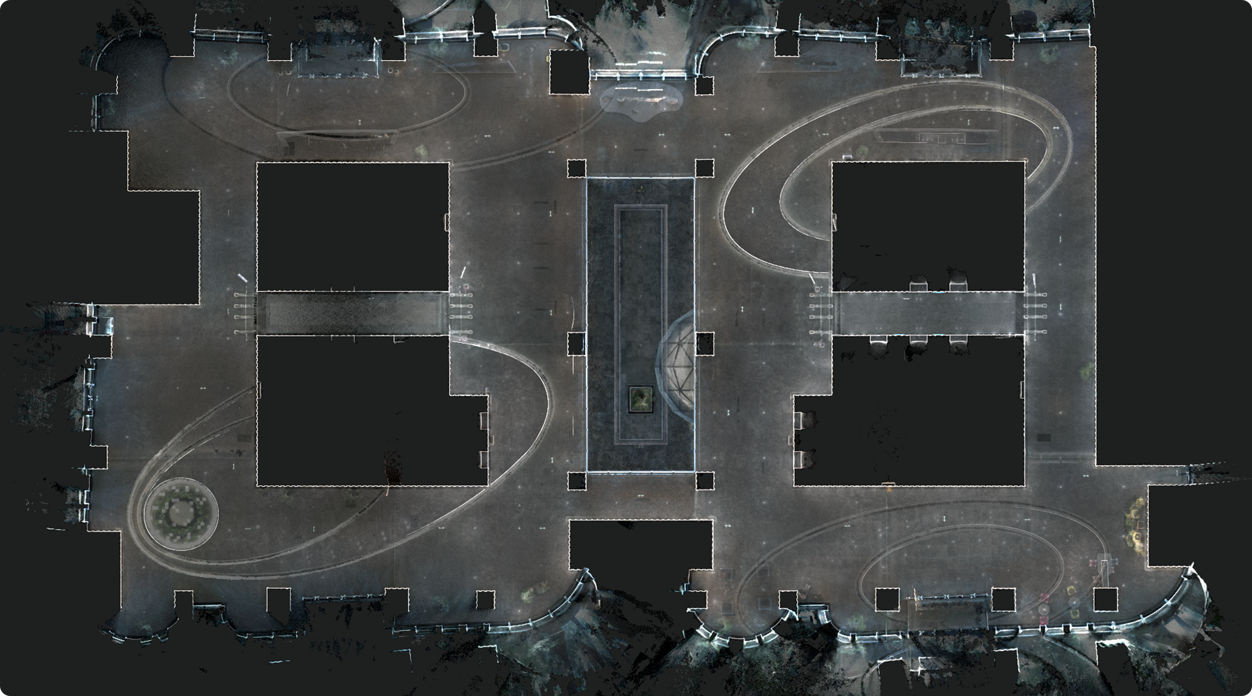
Feima SLAM200E lobby point-cloud example

Explore a lobby in 3D

This overhead lobby point-cloud view shows how captured geometry reveals the layout of an indoor space. Use a 3D overview to examine the arrangement of walls, openings and circulation areas.

Shown: Feima’s lobby point-cloud overview.

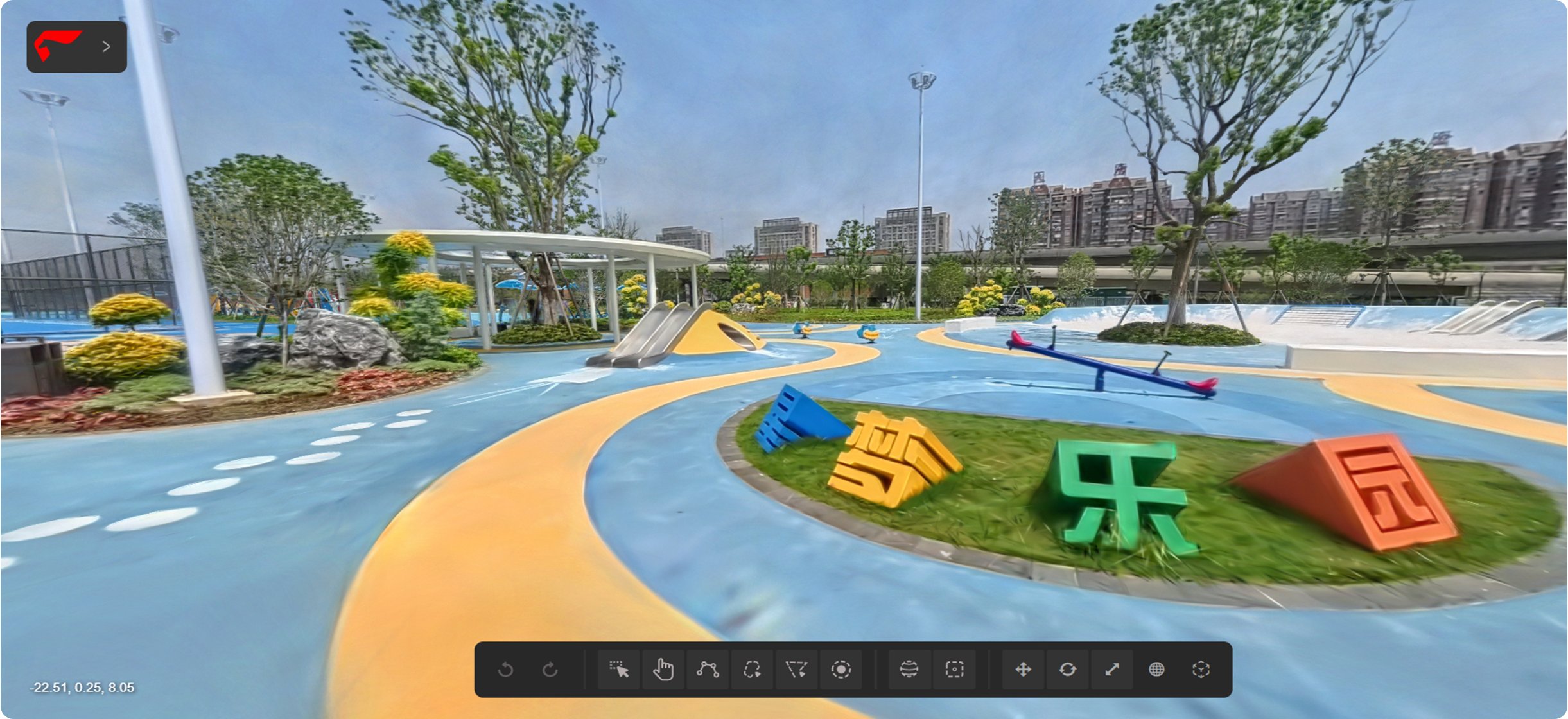
Feima SLAM200E visualisation of a colourful outdoor playground

Bring outdoor spaces to life

This playground visualisation shows how image textures add recognisable colour and context to a captured scene. SLAM200E’s dual panoramic cameras support workflows for presenting spaces in rich visual detail.

Shown: Feima’s outdoor playground visualisation.

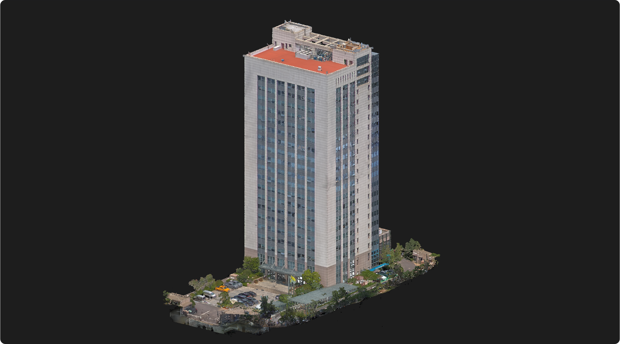
SLAM200E aerial and ground data example of a building and underground area

Capture buildings above and below ground

The building model shown brings the tower and its surrounding ground-level and underground geometry into one view. Feima’s aerial–ground fusion workflow combines complementary capture routes for broader coverage.

Shown: Feima’s 21-storey building and underground-area example. Accessories and workflow requirements apply.

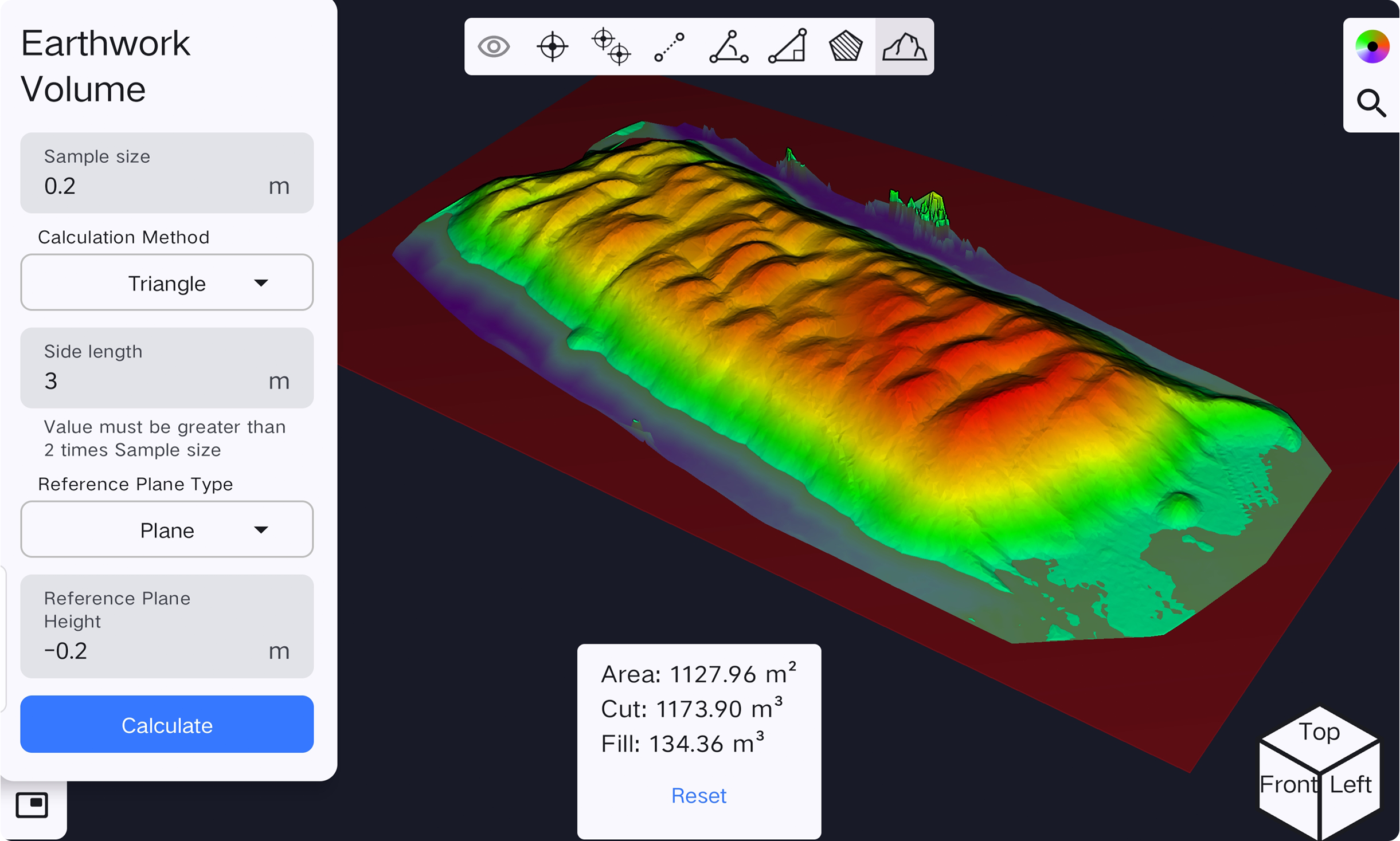
SLAM Instant earthwork volume screen showing a coloured surface and cut-and-fill results

Calculate earthwork volumes

The SLAM Instant screen shows a selected surface, reference-plane settings and calculated cut-and-fill volumes. Review volume measurements on site using captured 3D data.

Shown: SLAM Instant’s earthwork volume calculation screen.

On-site volume measurement

Calculate volumes with SLAM Instant

Watch Feima’s volume-calculation demonstration using SLAM200E data in SLAM Instant. See how captured 3D data is used to measure volumes on site.

Manufacturer demonstration and example results. These are not MMS Design project results or downloadable survey datasets.

A practical field-to-office workflow

Capture. Check. Deliver.

01

Capture your site

Walk the space with SLAM200E. Plan your scan route and survey control to suit the environment and required accuracy.

02

Check on site

Review real-time coloured point clouds and use SLAM Instant for supported field measurements.

03

Prepare the deliverable

Use the appropriate Feima processing workflow, including SLAM GO POST Pro, and confirm exports for your downstream software.

Request SLAM200E sample data & a demo

Your SLAM200E questions, answered

Can I scan indoors without GNSS?

Yes. SLAM200E supports mapping in GNSS-denied environments. Achievable accuracy still depends on the scene, scan route and processing workflow.

What is needed for georeferenced results?

External RTK or ground control can provide an absolute reference. Feima states absolute accuracy of up to 2 cm with RTK or GCP integration; confirm the survey method and acceptance criteria for your project.

Can I evaluate sample data before choosing a scanner?

Contact MMS Design with your application, required deliverable and preferred software. Request representative SLAM200E data and a demonstration to assess detail, coverage and workflow compatibility.

Which accessories and software do I need?

The right configuration depends on your capture platform, positioning requirements and outputs. Ask MMS Design to confirm the included hardware, software, licences, accessories and training in your quotation.

Product imagery and demonstrations: Feima Robotics SLAM200E. Performance figures are manufacturer specifications and are subject to operating conditions.

© 2026 MMS Design | All Rights Reserved