
LT800H
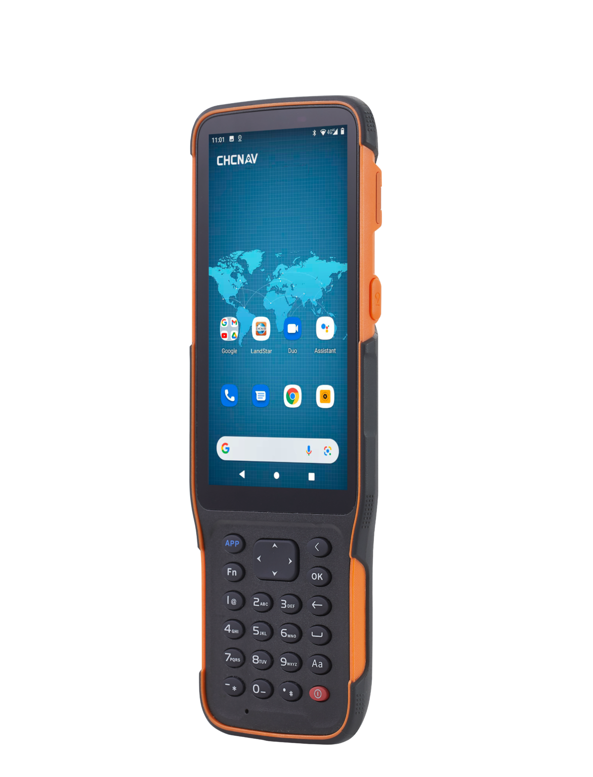
Featuring Android 10 operating system
The HCE600 features a powerful Helio MTK 6762 eight-core processor that delivers the best performance, runs 50% faster, and consumes 25% less power than its predecessors.
The Android 10 operating system enables smooth CAD drawing management and base map display.
High-performance LPDDR4 memory transfers data faster, delivering instant uploads of large project files. The HCE600 comes with a built-in 4G cellular modem for a stable and reliable Internet connection and includes a 90-day trial version of LandStar 7 Surveying and Mapping App with integrated cloud services to share data and provide one-click remote support from anywhere.
A sleek, lightweight, premium design for a better experience in the field
The HCE600 is only 1.54 cm thick and weighs only 345 g, making it the ultimate ultra-lightweight handheld for surveying and mapping applications. Based on an ergonomic design optimized for field use, its one-handed grip provides excellent handling and easier operation. A customizable shortcut key on its side allows for one-step measurement for quick data entry. The all-day battery life provides uninterrupted data collection in the field.
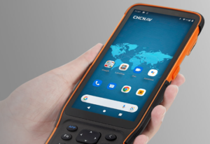
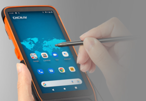
Perform your data collection tasks in the field more efficiently
The high-brightness 5.5-inch HD+ display makes viewing your projects more comprehensive and intuitive. Complex survey projects, DXF base maps, and data tables are displayed with more details to enhance the viewing experience. With up to 500 nits brightness, your data always remains easily readable for operations in all weather conditions, whether in direct sunlight or on a rainy day. Projects and maps are accessible in your working environment, allowing you to focus on your tasks in the most efficient way.
Shock, dust, and water-resistant
The HCE600 Asahi DragonTrail™ glass display is ultra-tough and scratch-resistant, providing long-term performance and great protection against everyday wear or accidental drops up to 1.5 m. MIL-STD 810 certification and IP67 rating provide the backbone for extreme durability and reliability in typical surveying and construction site environments. The nine-axis compass and gyro fusion algorithm corrects errors due to magnetic interference to provide accurate heading information. Common surveying applications, such as GNSS RTK stakeout surveys, are always performed with greater efficiency.

LT800H
Featuring Android 10 operating system
The HCE600 features a powerful Helio MTK 6762 eight-core processor that delivers the best performance, runs 50% faster, and consumes 25% less power than its predecessors.
The Android 10 operating system enables smooth CAD drawing management and base map display.
High-performance LPDDR4 memory transfers data faster, delivering instant uploads of large project files. The HCE600 comes with a built-in 4G cellular modem for a stable and reliable Internet connection and includes a 90-day trial version of LandStar 7 Surveying and Mapping App with integrated cloud services to share data and provide one-click remote support from anywhere.
A sleek, lightweight, premium design for a better experience in the field
The HCE600 is only 1.54 cm thick and weighs only 345 g, making it the ultimate ultra-lightweight handheld for surveying and mapping applications. Based on an ergonomic design optimized for field use, its one-handed grip provides excellent handling and easier operation. A customizable shortcut key on its side allows for one-step measurement for quick data entry. The all-day battery life provides uninterrupted data collection in the field.
Perform your data collection tasks in the field more efficiently
The high-brightness 5.5-inch HD+ display makes viewing your projects more comprehensive and intuitive. Complex survey projects, DXF base maps, and data tables are displayed with more details to enhance the viewing experience. With up to 500 nits brightness, your data always remains easily readable for operations in all weather conditions, whether in direct sunlight or on a rainy day. Projects and maps are accessible in your working environment, allowing you to focus on your tasks in the most efficient way.
Shock, dust, and water-resistant
The HCE600 Asahi DragonTrail™ glass display is ultra-tough and scratch-resistant, providing long-term performance and great protection against everyday wear or accidental drops up to 1.5 m. MIL-STD 810 certification and IP67 rating provide the backbone for extreme durability and reliability in typical surveying and construction site environments. The nine-axis compass and gyro fusion algorithm corrects errors due to magnetic interference to provide accurate heading information. Common surveying applications, such as GNSS RTK stakeout surveys, are always performed with greater efficiency.
OVERVIEW
The HCE600 is a lightweight, compact, professional Android 10 data collector with an alphanumeric keypad, specifically designed for surveying and mapping operations in the field. Its 5.5-inch DragonTrail™ display offers extreme durability, long-term performance, and incredible sunlight readability.
Packed with connectivity modules including Bluetooth 5.0, dual-band 2.4G and 5G Wi-Fi, 4G modem, and more, the HCE600 connects seamlessly and reliably to your favorite GNSS receivers and RTK network correction sources. Ultra-rugged, it withstands a 1.5-meter drop on concrete and meets stringent IP67 and MIL-STD-810H standards.
The HCE600 is the optimal handheld controller for working in harsh field environments and making your data collection easier and more efficient. The HCE600 comes with a 90-day trial version of the LandStar Surveying and Mapping App, trusted by over 100,000 professionals worldwide.
SPECIFICATIONS:
Specification: HCE600_DS_EN.pdf
Contact Details
086 111 2783
021 975 7043
Quick Links
Home
Shop Online
Get a Quote
Software
Equipment
Training
Privacy Policy
Contact Us
Social Media
© 2025 MMS Design | All Rights Reserved | Web SEO by: DNASuperSystems