
Pix4Dmapper Photogrammetry Software
The leading photogrammetry software for professional drone mapping
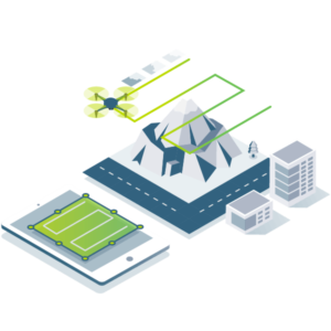
Capture
Capture RGB, thermal or multispectral images with any camera.
If you are using a drone, automate flight and image-data transfer with the free Pix4Dcapture app.
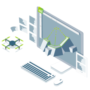
Digitize
Pix4Dmapper transforms your images into digital spatial models.
Seamlessly process your projects using the cloud or the desktop photogrammetry platform.
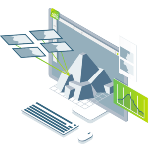
Control
Assess and improve the quality of your project.
The quality report gives a preview of the generated results, calibration details, and many more project quality indicators.
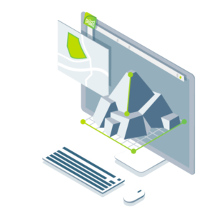

Measure & inspect
Measure distances, areas, and volumes.
Extract elevation profile data and perform virtual inspections.
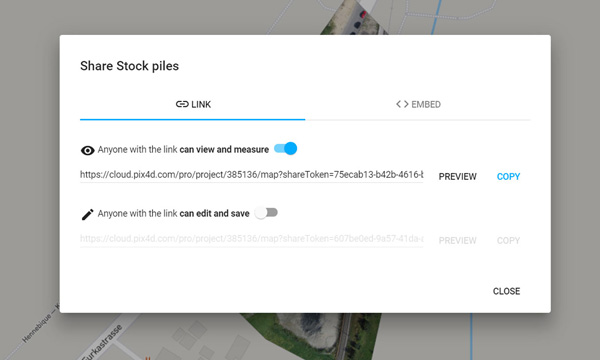
Collaborate & share
Streamline project communication and teamwork.
Selectively and securely share project data and insights with your team, clients, and suppliers, with standard file formats or online with Pix4DCloud.
Pix4Dmapper Photogrammetry Software
The leading photogrammetry software for professional drone mapping
Capture
Capture RGB, thermal or multispectral images with any camera.
If you are using a drone, automate flight and image-data transfer with the free Pix4Dcapture app.
Digitize
Pix4Dmapper transforms your images into digital spatial models.
Seamlessly process your projects using the cloud or the desktop photogrammetry platform.
Control
Assess and improve the quality of your project.
The quality report gives a preview of the generated results, calibration details, and many more project quality indicators.
Measure & inspect
Measure distances, areas, and volumes.
Extract elevation profile data and perform virtual inspections.
Collaborate & share
Streamline project communication and teamwork.
Selectively and securely share project data and insights with your team, clients, and suppliers, with standard file formats or online with Pix4DCloud.
A variety of tools to power applications across industries
Desktop & cloud
Survey-grade results
Complete control over your project
Your workflow, your choice
Obtain results with sub-centimetre accuracy.
1-2 pixel GSD in X, Y directions
1-3 pixels GSD in the Z direction
Define an area of interest, select processing options, add ground control points or edit point clouds, DSMs, meshes, and orthomosaics.
Use default templates for automatic processing, or custom settings for full control of quality, data, and projects. Choose when and how to use the cloud and desktop processing.
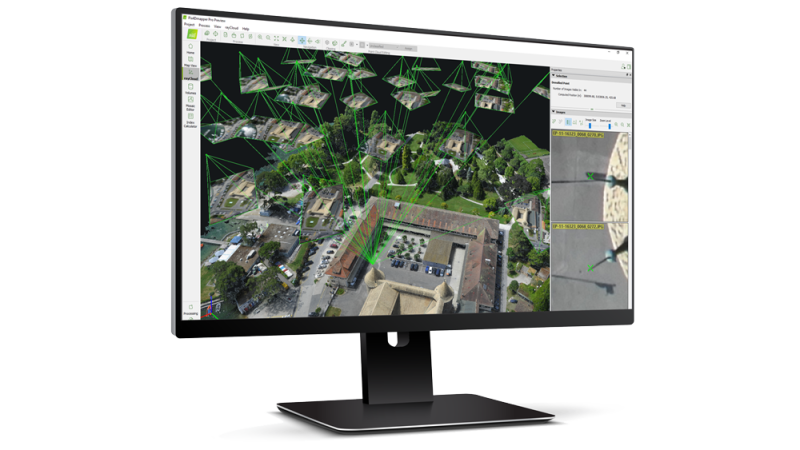
rayCloud
The power of photogrammetry software
A unique environment connecting your original images to each point of the 3D reconstruction to visually verify and improve the accuracy of your project.
A variety of tools to power applications across industries
Desktop & cloud
Survey-grade results
Obtain results with sub-centimetre accuracy.
1-2 pixel GSD in X, Y directions
1-3 pixels GSD in the Z direction
Complete control over your project
Define an area of interest, select processing options, add ground control points or edit point clouds, DSMs, meshes, and orthomosaics.
Your workflow, your choice
Use default templates for automatic processing, or custom settings for full control of quality, data, and projects. Choose when and how to use the cloud and desktop processing.
rayCloud
The power of photogrammetry software
A unique environment connecting your original images to each point of the 3D reconstruction to visually verify and improve the accuracy of your project.
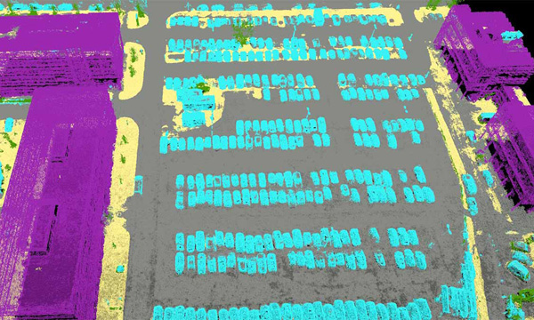
Automatic point cloud classification
Distinguish objects with machine learning classification processes.
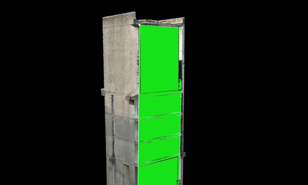
Flatten & smoothen digital surfaces
Create surfaces to improve planarity or fill holes in critical areas.
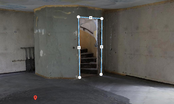
Easily measure surface, distance, volume & elevation
Measure in 3D with a fully-adjustable base height.
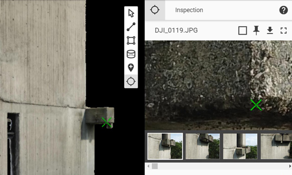
Inspect & Annotate
Remotely inspect projects and accurately pinpoint, highlight and describe critical elements.
Collaborate & Share
Selectively and securely share project data and insights with your team, clients or other stakeholders.
Automatic point cloud classification
Distinguish objects with machine learning classification processes.
Flatten & smoothen digital surfaces
Create surfaces to improve planarity or fill holes in critical areas.
Easily measure surface, distance, volume & elevation
Measure in 3D with a fully-adjustable base height.
Inspect & Annotate
Remotely inspect projects and accurately pinpoint, highlight and describe critical elements.
Collaborate & Share
Selectively and securely share project data and insights with your team, clients or other stakeholders.
Photos first
Any camera. Any drone. Any imagery. As long as it’s a .jpg or a .tif.
Your projects. Your tools.
Easily export your digital maps and models to industry-compatible formats for further analysis or reporting.
Constant Updates & World-class Support Services
All of our Software and Survey Equipment are covered by world-class support.
We provide unmatched user support and training on everything we sell.
Contact Details
086 111 2783
021 975 7043
Quick Links
Home
Shop Online
Get a Quote
Software
Equipment
Training
Privacy Policy
Contact Us
Social Media
© 2025 MMS Design | All Rights Reserved | Web SEO by: DNASuperSystems