
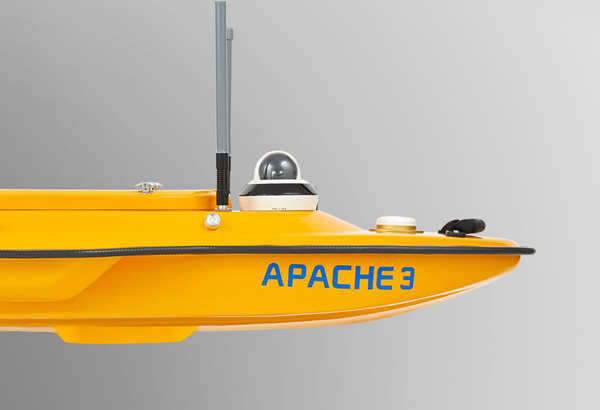
Apache3 USV
Apache3 USV
Autonomous hydrographic and bathymetric surveys USV
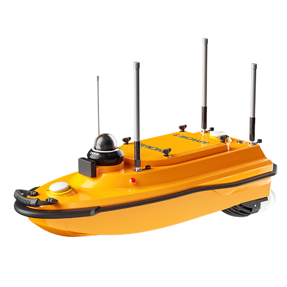
Apache3 USV
Autonomous hydrographic and bathymetric surveys USV
ADVANCED NAVIGATION CONTROLLER
Adaptive water flow straight-line and hovering technology
The APACHE 4 control system enables to navigate straight along the cross-section according to the profile view when the flow rate, turbulence, etc. change. The hovering technology can make APACHE 4 hover stably in the turbulent flow at the start and end points of ADCP observation, thereby improving the accuracy of flow estimation.
COMPATIBLE WITH COMMON ADCP
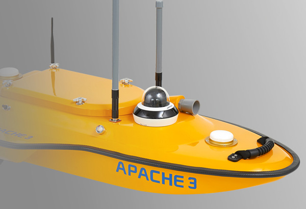
Integrated IMU to overcome temporary GNSS outage
The integration of GNSS and IMU sensor provides accurate position and attitude data to compensate for hull sway on survey results. The Apache3 provides consistently high accuracy positions even during temporary GNSS outages while passing under bridges. Tight integration of GNSS and INS data eliminates outliers.
COMPATIBLE WITH COMMON ADCP
Integrated IMU to overcome temporary GNSS outage
The integration of GNSS and IMU sensor provides accurate position and attitude data to compensate for hull sway on survey results. The Apache3 provides consistently high accuracy positions even during temporary GNSS outages while passing under bridges. Tight integration of GNSS and INS data eliminates outliers.
MAKE SURVEY POSSIBLE IN MOST WATER CONDITIONS
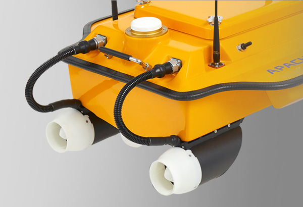
High-efficiency maritime design propulsion
High-efficiency maritime design propulsion DC-injection rotary motor technology provides a 40% increase in energy conversion efficiency. The motor’s high speed (7,000 rpm), anti-collision design with a sealed straw cover with oblique titanium alloy mesh and anti-corrosion design (resistant to one month’s immersion in sea water) make it extremely durable.
MAKE SURVEY POSSIBLE IN MOST WATER CONDITIONS
High-efficiency maritime design propulsion
High-efficiency maritime design propulsion DC-injection rotary motor technology provides a 40% increase in energy conversion efficiency. The motor’s high speed (7,000 rpm), anti-collision design with a sealed straw cover with oblique titanium alloy mesh and anti-corrosion design (resistant to one month’s immersion in sea water) make it extremely durable.
ABSOLUTE LINEAR TECHNOLOGY
Maintain a perfect straight sailing course even in complex current conditions
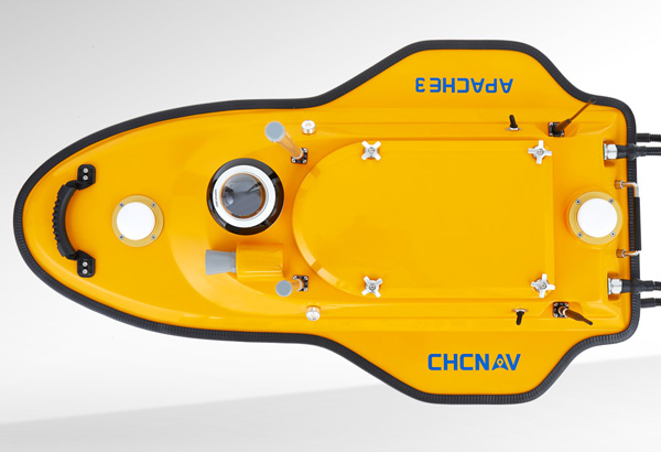
Integrate high precision GNSS positioning and heading technology to ensure high accuracy bathymetric survey in fully autonomous mode. With less than 1 m length and pocket-hulled vessel design, the APACHE3 supports operation in shoals, channels, and shallow rivers for the bathymetric survey without run aground.
ABSOLUTE LINEAR TECHNOLOGY
Maintain a perfect straight sailing course even in complex current conditions
Integrate high precision GNSS positioning and heading technology to ensure high accuracy bathymetric survey in fully autonomous mode. With less than 1 m length and pocket-hulled vessel design, the APACHE3 supports operation in shoals, channels, and shallow rivers for the bathymetric survey without run aground.
OVERVIEW
The APACHE3 is a portable shallow-draft hull with a single beam echo sounder for bathymetric surveys of lakes, inland rivers, and coastal areas. The master control unit provides seamless 4G communication, removing the limitations of traditional network bridge base stations and transmission distances, making hydrographic survey easier.
The APACHE3 USV combines a dual GNSS positioning and heading sensor, a stable and reliable hull attitude and an IMU sensor, allowing uninterrupted survey while passing below bridges. The high efficiency 5 m/s motors and absolute straight-line technology allow a fully automatic pre-determined course in autonomous mode under adverse current and flow conditions.
SPECIFICATIONS
Wide-coverage dual-camera LiDAR for demanding UAV surveys
Up to 2,100 m range
Up to 2,000 kHz pulse rate
Up to 16 returns
1.85 kg integrated system
CHCNAV AlphaAir 6 Dual (AA6D)
Capture LiDAR and high-quality imagery across wide corridors and large-area projects with dual 26 MP APS-C cameras and a 110° horizontal field of view.
TX73 GNSS Guidance
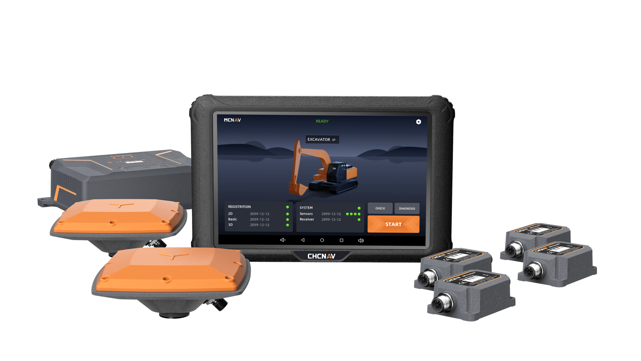
Premium RTK GNSS Excavator Guidance
Social Media
© 2025 MMS Design | All Rights Reserved | Web SEO by: DNASuperSystems